by Randy Bradt, Minnesota Department of Natural Resources
Meeker County has an interesting example of elevated pollution sensitivity resulting from glacial meltwaters removing overlying protective material above one of the shallow buried sand aquifers.
Pollution sensitivity, groundwater recharge conditions and flow directions, water chemistry, and other findings are reported in the Meeker County Groundwater Atlas (Part B), recently published by the Minnesota Department of Natural Recourses (DNR). This Part B expands on the Geologic Atlas of Meeker County, Minnesota (Part A) published by the Minnesota Geological Survey (MGS).
Located approximately 40 miles west of the Twin Cities in south-central Minnesota (Figure 1), Meeker County’s predominant land use is row crop agriculture. Notably, it has some of Minnesota’s largest dairy and poultry operations.
The county lies within portions of four major watersheds:
- North Fork Crow River
- South Fork Crow River
- Sauk River
- Mississippi River–St. Cloud
The watersheds drain surface waters east, eventually flowing to the Mississippi River. The county has numerous lakes and the topography ranges from nearly level to rolling terrain. Almost 6 percent of the county is open water.
Glacial history and Meeker County water today
Surficial geologic materials in Meeker County consist primarily of sediment of the New Ulm Formation deposited during the Wisconsinan Episode (Part A, Plate 3). Ice carried sediment into the county from two different origins (provenances). The Rainy provenance (northeast of Minnesota) contributed sediment of the Hewitt Formation, carried by the Wadena lobe ice. After its retreat, the Riding Mountain provenance (northwest of Minnesota) contributed New Ulm Formation sediment in three successive advances of the Des Moines lobe (Part A, Plate 3, Figure 2).
These unconsolidated sediments are an unsorted mix of sand, silt, and clay sized materials (till). Water does not readily move through this material and therefore till is considered an aquitard. During each ice lobe retreat, the meltwaters reworked glacial sediment and deposited sand and gravel. If there is sufficient saturated thickness, these layers serve as aquifers. The thickest and most extensive surficial sand and gravel deposits are in the:
- Center of the county, where glacial streams deposited sandy sediment in glacial Lake Litchfield, and
- North-central and northwestern portions of the county, where glacial stream deposits (outwash) dominate at the land surface
Because the soils associated with these surficial sands are susceptible to drought conditions, most irrigation wells are located here.
Pollution sensitivity and hydrogeologic cross sections
The report contains two types of pollution sensitivity maps:
- Pollution sensitivity of near-surface materials (one map)
- Buried aquifer sensitivity (13 maps)
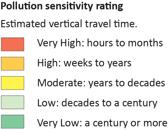
Buried aquifer pollution sensitivity varies from very low to very high throughout the county and is dependent on the depth of the aquifer and the thickness of overlying aquitard materials. The three shallowest buried sand aquifers (nts, ms, and hs) typically have higher pollution sensitivities over their mapped extent. The remaining deeper aquifers have very low pollution sensitivity over most of their mapped extent.
Ten sites sampled, using the carbon-14 dating method, found groundwater residence times ranging from 550 to 8,500 years. Residence times determined using tritium found that recharge over the last approximately 60 years is generally limited to no more than 100 feet. The deepest aquifers with tritium present are usually in areas where surficial and buried sands overlap with little or no intervening till enabling more rapid and focused recharge.
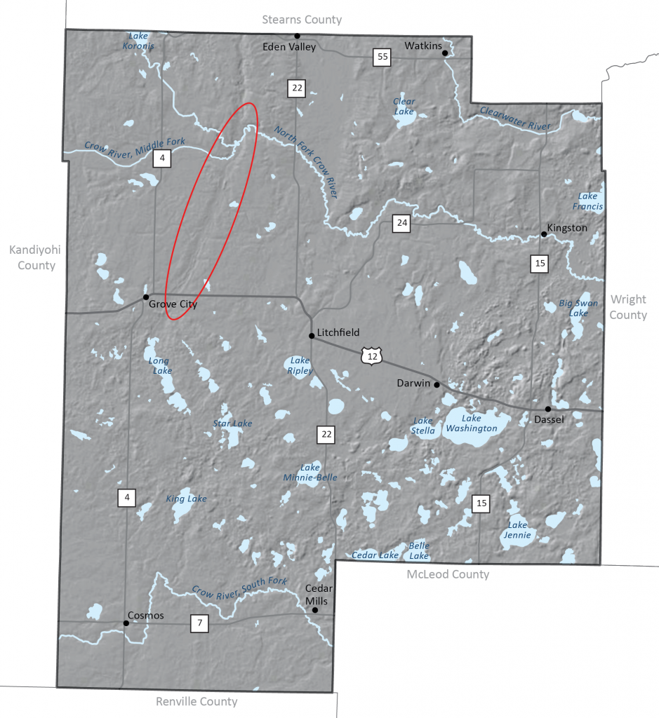
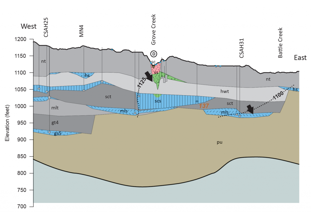
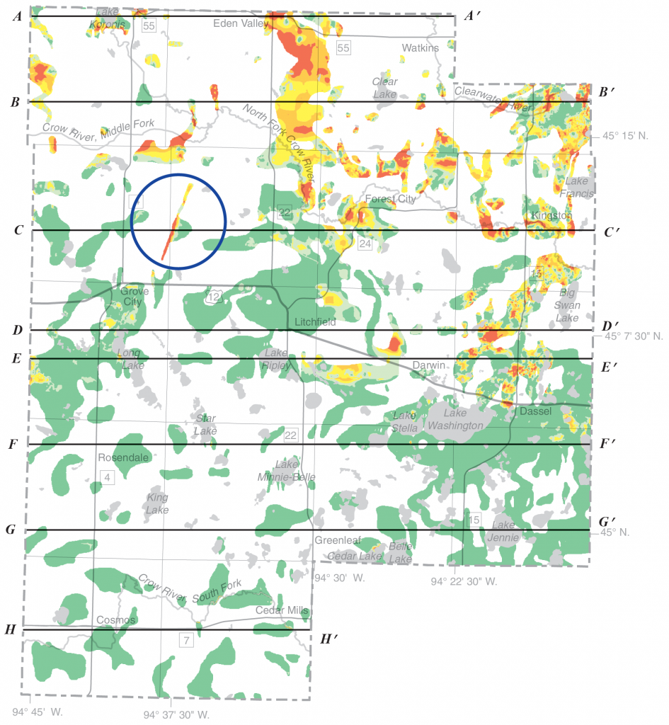
Areas of elevated pollution sensitivity are often associated with focused groundwater recharge. One example is a glacial channel feature in northwest Meeker County extending from a few miles southwest of Eden Valley to near Grove City. This feature is visible and circled in red on the enhanced light detection and ranging (LIDAR) image in Figure 1. This trough is a valley cut by glacial meltwater flowing beneath the ice near the end of the ice age. Figure 2 shows this channel in cross section coincident with Grove Creek. The channel removed the thick aquitard that protects the underlying hs buried sand aquifer causing the surficial sand and the underlying hs aquifer to be in direct communication. This channel is also shown in Figure 3 within the blue circle. On the west end of cross section C–C’, the hs aquifer generally has a very low pollution sensitivity rating. However, you can clearly see the narrow very high pollution sensitivity area trending northeast to southwest.
Click on the buttons below to obtain a copy of the Meeker County Groundwater Atlas or any other completed Groundwater Atlas.
 RSS - Posts
You must be logged in to post a comment.