by Vanessa Baratta, Minnesota DNR
The Morrison County Groundwater Atlas (Part B) was recently published by the Minnesota Department of Natural Resources (DNR). It reports the pollution sensitivity, groundwater recharge conditions and flow directions, water chemistry, and other findings. This Part B expands on the Geologic Atlas of Morrison County, Minnesota (Part A) published by the Minnesota Geological Survey (MGS).
Morrison County is located in central Minnesota, with the Mississippi River flowing south through the west-central part of the county. Portions of five major watersheds are present, with almost 90 percent of the water flowing into the Mississippi River (Figure 1). Many of the fine-grained layers (tills) beneath the land surface have a high sand content allowing water to move rapidly through it.

Buried sand and gravel units across the county are abundant and are connected to the land surface in many places without an intervening fine-grained layer. Flow is primarily moving toward the Mississippi River in both the unconfined and buried aquifers. The deeper Precambrian bedrock is not often used as a water resource due to its limited porosity and permeability.
The county is a very good example of the impact of sandy surficial and buried materials on pollution sensitivity and groundwater flow. Groundwater residence time indicated that precipitation reached the groundwater within the last 60 years across many parts of the county. A significant amount of anthropogenically sourced chloride and nitrate was present, indicating a relatively short travel time from the surface to multiple groundwater resources.
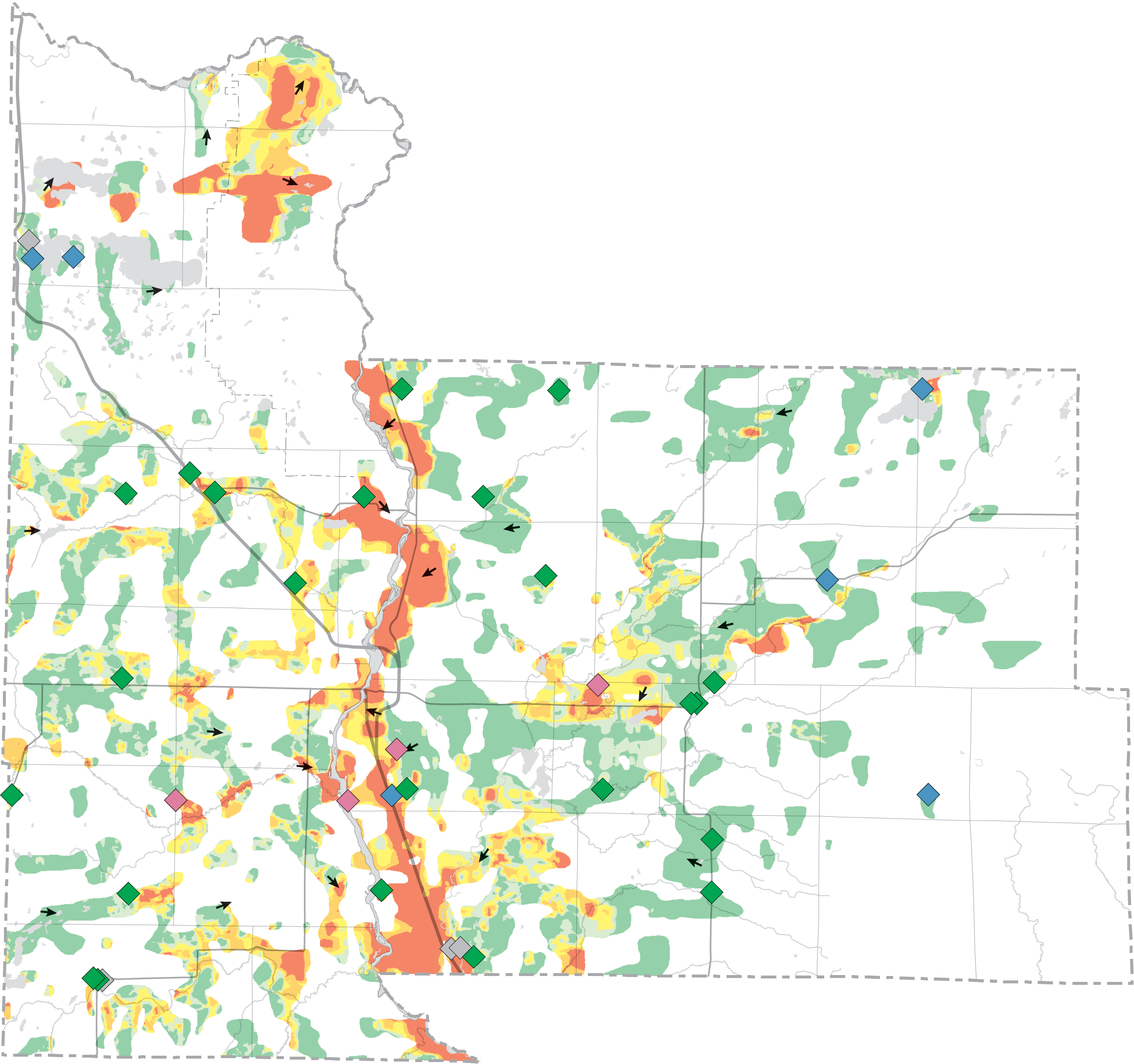
All of the buried sand and gravel aquifers have areas of very high pollution sensitivity along the Mississippi River and some of the larger tributaries flowing into it (Figure 2). Areas of very low pollution sensitivity are present in the uplands between the rivers. However, chemistry data indicates that water is still moving relatively quickly through these areas.
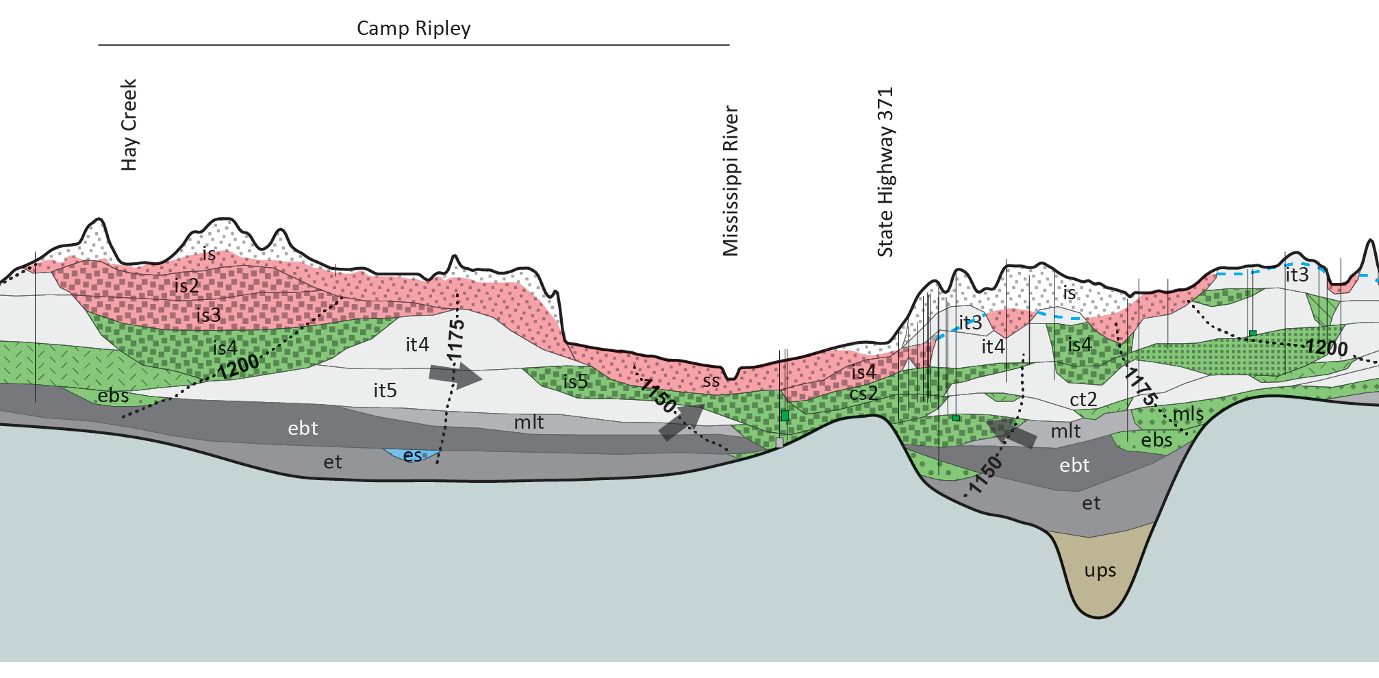
The cross sections on report plates show that groundwater flows downward and laterally toward the Mississippi River and some of the major tributaries that receive groundwater discharge as base flow. Groundwater recharges quickly across the entire county because of the aquifers or sandy tills at the surface. In some areas these are in contact with buried aquifers, allowing for faster recharge (Figure 3).
 RSS - Posts
You must be logged in to post a comment.