By Greg Brick, Ph.D.
The secret to mapping springs for the Minnesota Spring Inventory (MSI) was LIDAR. Given that the glaciated portion of the state outside the southeastern karst counties was a blank slate when MSI began work in 2014, a rapid reconnaissance tool was required to economize on limited resources. Forked twigs were not an option!
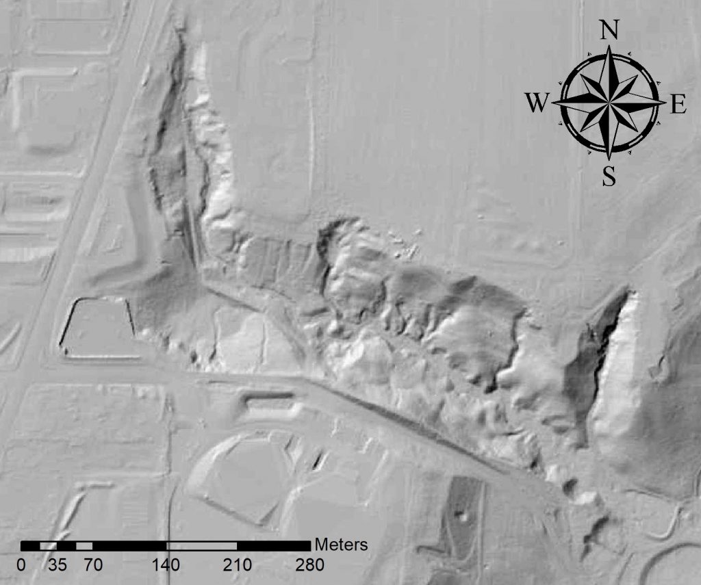
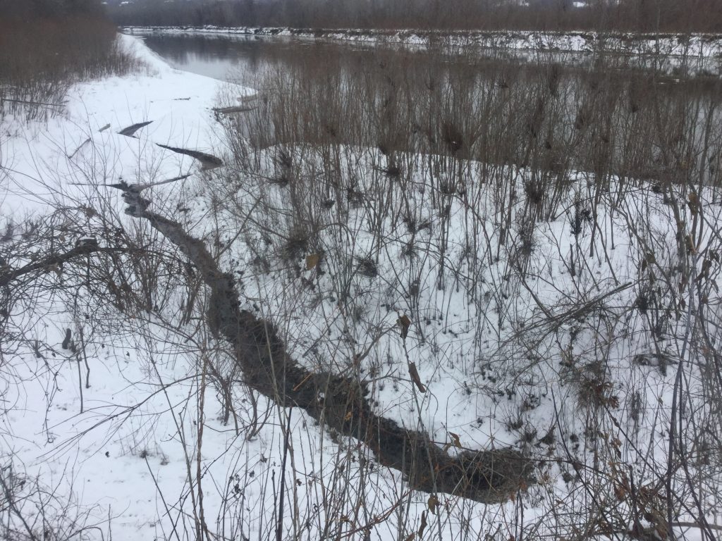
More specifically, it was the so-called “spirilliform signature” of springs on LIDAR that did the trick. A spirilliform is the erosional squiggle carved by the spring, usually along blufflines, shorelines, moraines, outwash, and so forth (Fig. 1). Their sharply incised, isolated character made them strangely conspicuous on LIDAR. Springs with a discharge of as little as one gallon per minute could be spotted on one-meter resolution LIDAR at 1:24,000 scale. But of course, you’d usually want to be more zoomed in than that. As for the whimsical etymology, electron microscopy generates grayscale images that superficially resemble those of LIDAR. The term “spirilliform” was borrowed from microbiology, where it refers to spiral-shaped bacteria, and applied to geomorphology. It sounded more dignified than “squiggles” and was more inclusive than the term “spring run” (Fig. 2).
The spirilliform method allowed extensive public lands to be rapidly assessed for their spring potential ahead of time so that field mapping could remain tightly focused. This was especially crucial in remote field areas, which involve significant travel expenditures.
Now for the caveats. Not all spirilliforms were tiny spring runs, some were merely surface drainage. But once it was determined by field check that a given spirilliform was a spring run, the same was true of others in the same landscape setting. However, if no spirilliforms at all were seen, no springs would usually be found, and the area could be added to the list of low-priority “deadgrounds.” In non-glaciated country where spring inventories are conducted, such as the southwestern USA, airphotos have some advantages over LIDAR. Think of the clumps of greenery seen around desert springs.
Looking ahead, perhaps spirilliforms exist on other planets. At a time when “Martian analogues” are all the rage, perhaps we’ll be able to see Martian spirilliforms—the dried remains of former Martian springs. Judging from Google Mars, NASA’s HiRISE camera has sufficient resolution, but its coverage is rather limited at present.
 RSS - Posts
You must be logged in to post a comment.